Underwater Exploration
Sklives Mine
Using old maps of the French Mining Company of Lavrion the team first began their investigation to locate the engine a year ago when they visited Mine 80 and dived three different flooded sections. Although the dives were successful in revealing new and never seen underwater sections, the mission failed to locate the engine or any remnants of other mining tools.
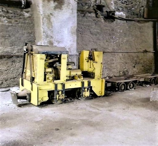
The drilling works at the well of Sklives had started between 1920 and 1930. The miners then reached the 3rd metalliferous contact where partial mine exploitation was done and then these galleries were abandoned. In the 1970’s drilling was done in the area surrounding the well and new rich ore deposits were found. Upon this discovery in 1973 it was decided to open a large passage connecting the central mine 80 with the well at Sklives. This mine operated four more years until 1977 when it was finally abandoned. This information was shared with the team by Mr.Kostas Papathanasiou who was an engineer and worked at these mines. Furthermore, the engine used to extract the ore on large wagons and various other mining tools were left in place when the aquifer started to rise, eventually flooding and sealing the mine.
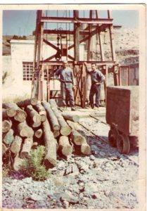
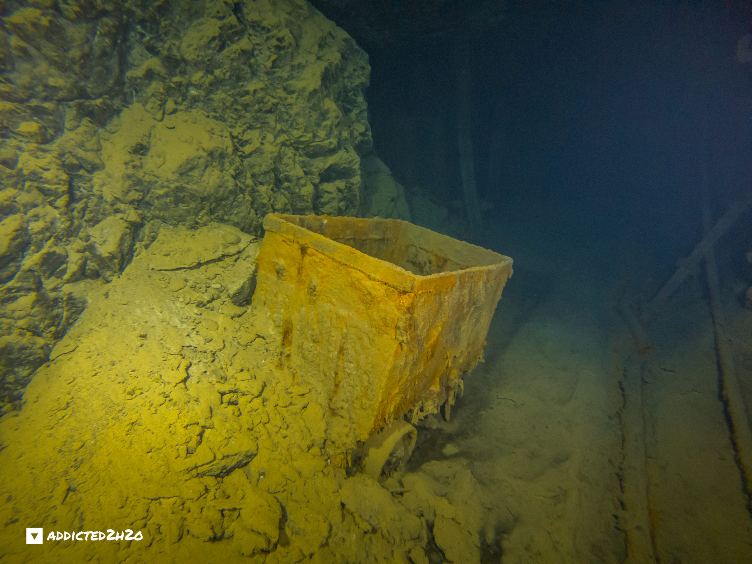
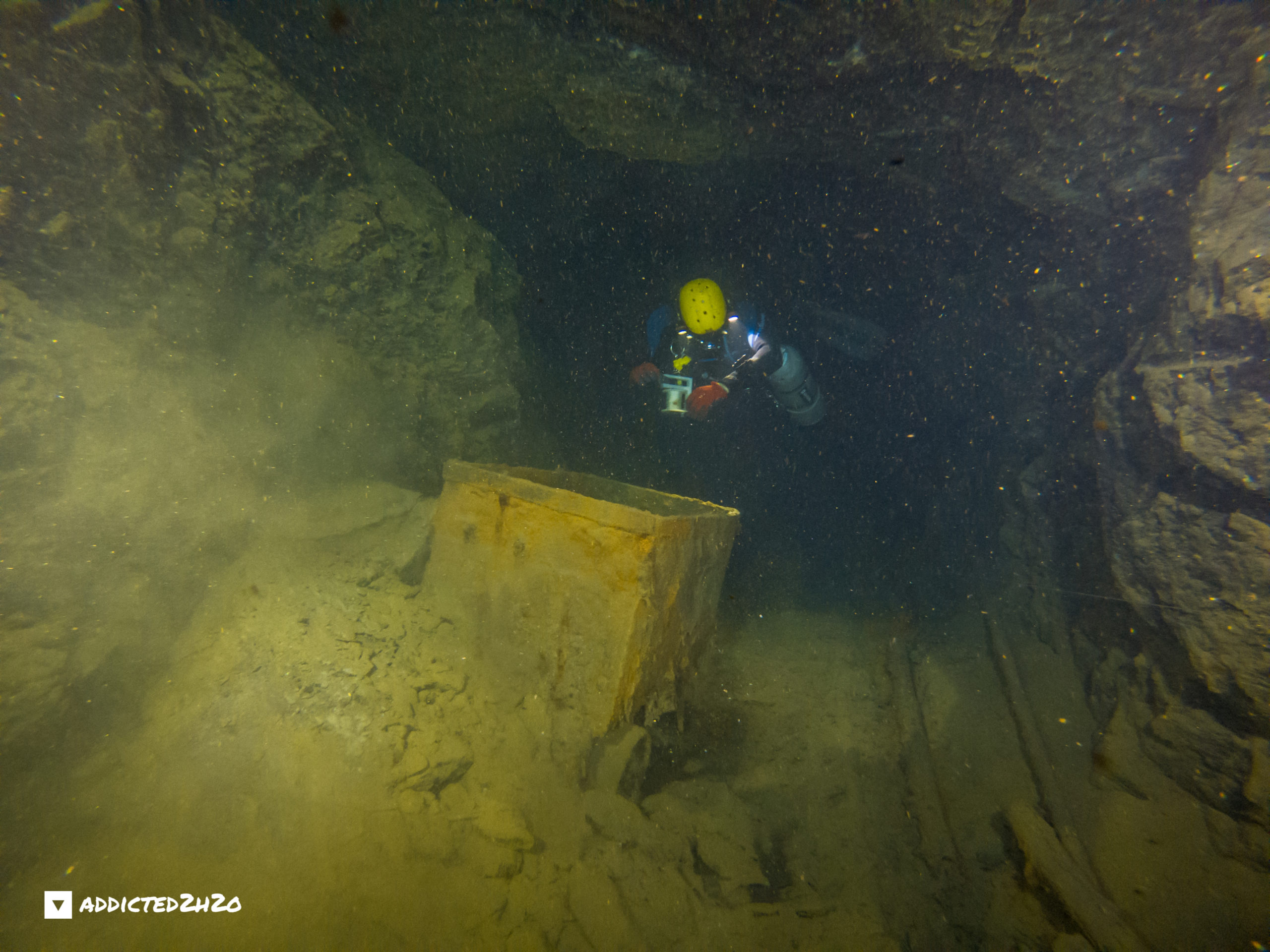
Above the well in the 1960’s. The ore cart and timber used as support beams in the galleries can be seen.
Photograph provided by Michalis Fitros. Archive: Markos Ninos.
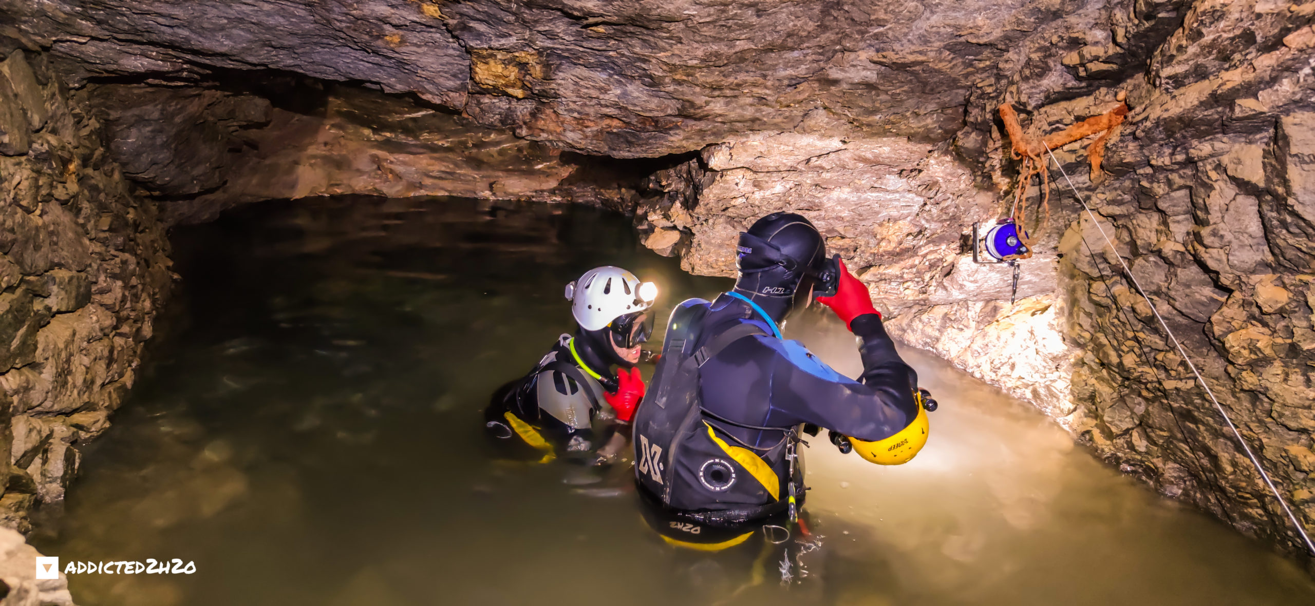
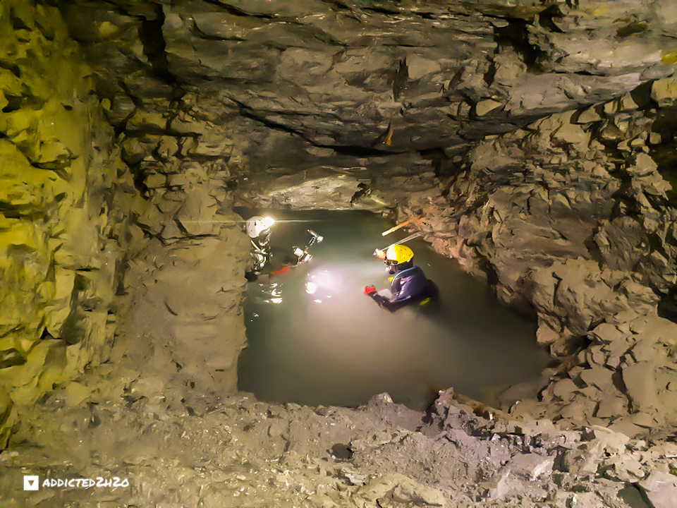
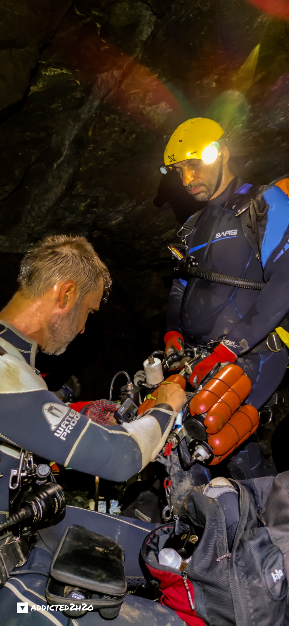
The well at Sklives mine reaches a maximum depth of 202 meters from the surface as stated in the construction plans archives of the French Mining Company of Lavrio. This was measured by the team on the 17th of April 2021 from the surface to the bottom of the flooded section at 135 meters. Part of the well was filled with debris in older times thus explaining the discrepancy. Access to this level at Sklives is extremely difficult as most of the approximately one and a half kilometers distance to reach the flooded section is on a 40 degree steep slope. Apart from transporting the dive gear another difficulty is gear configuration when the team reaches the dive site. Entrance to the water is situated at the bottom of a steep slope so all of the gear had to be prepped at fairly stable ground before carefully being transported one by one to the divers to begin their underwater exploration.
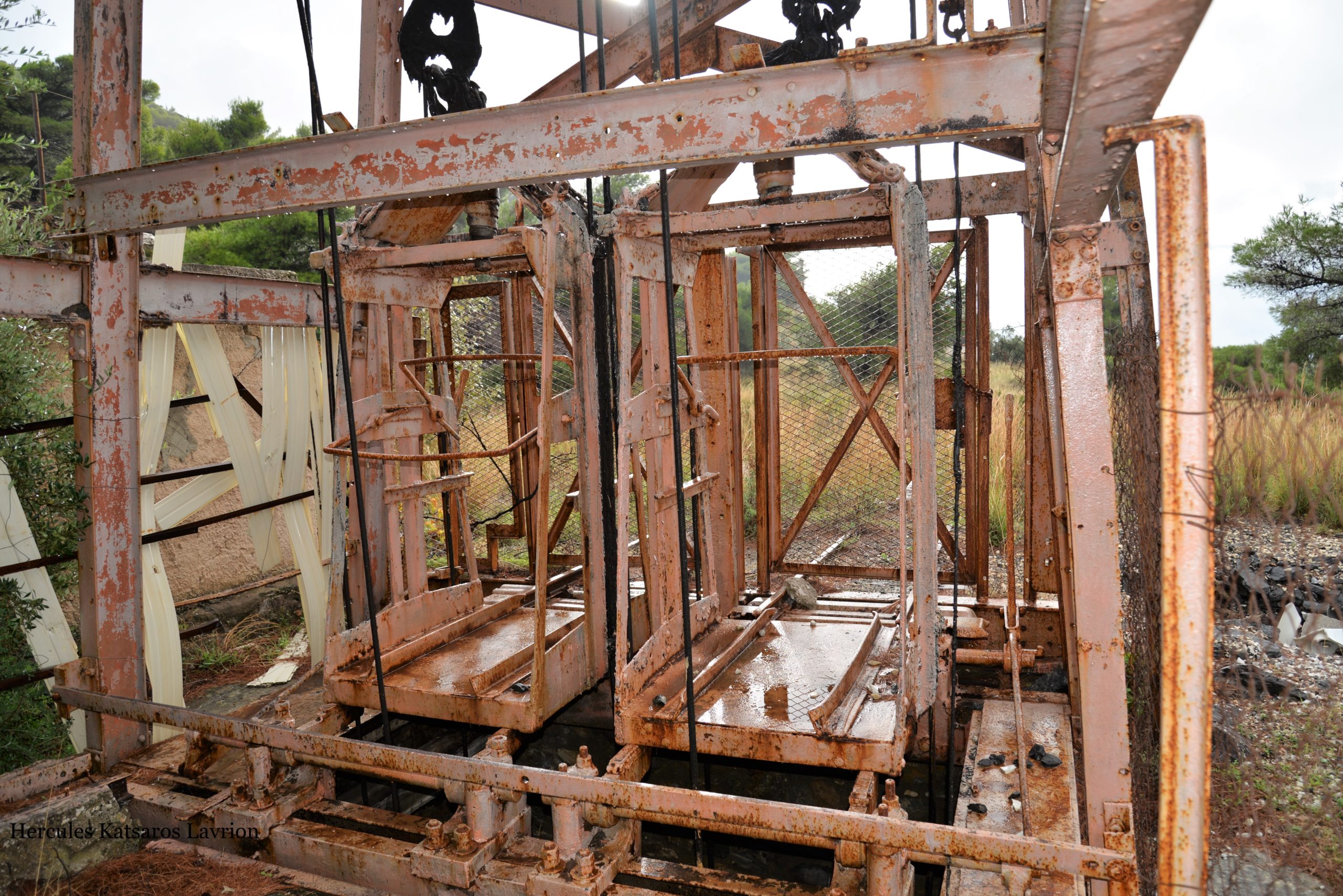
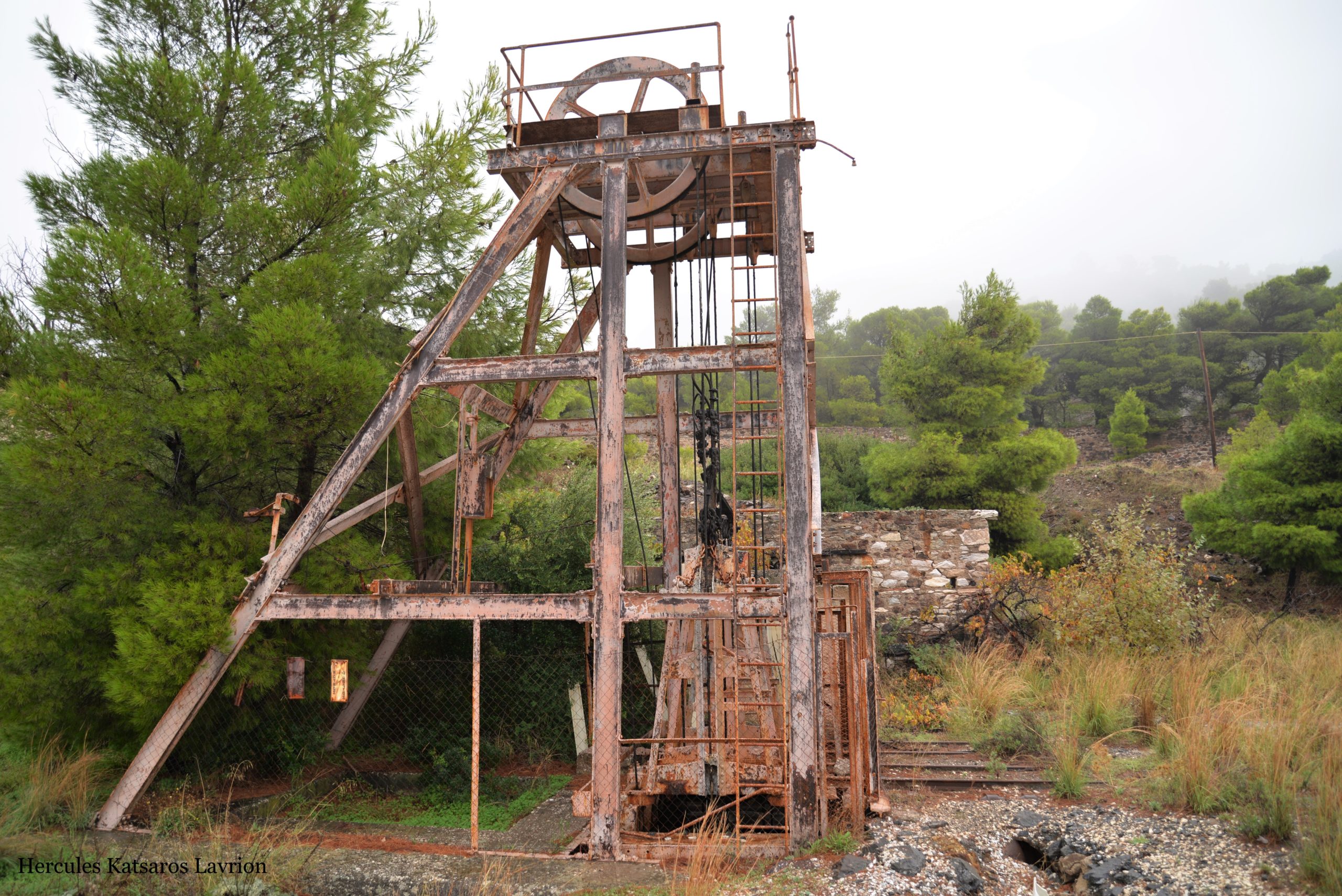
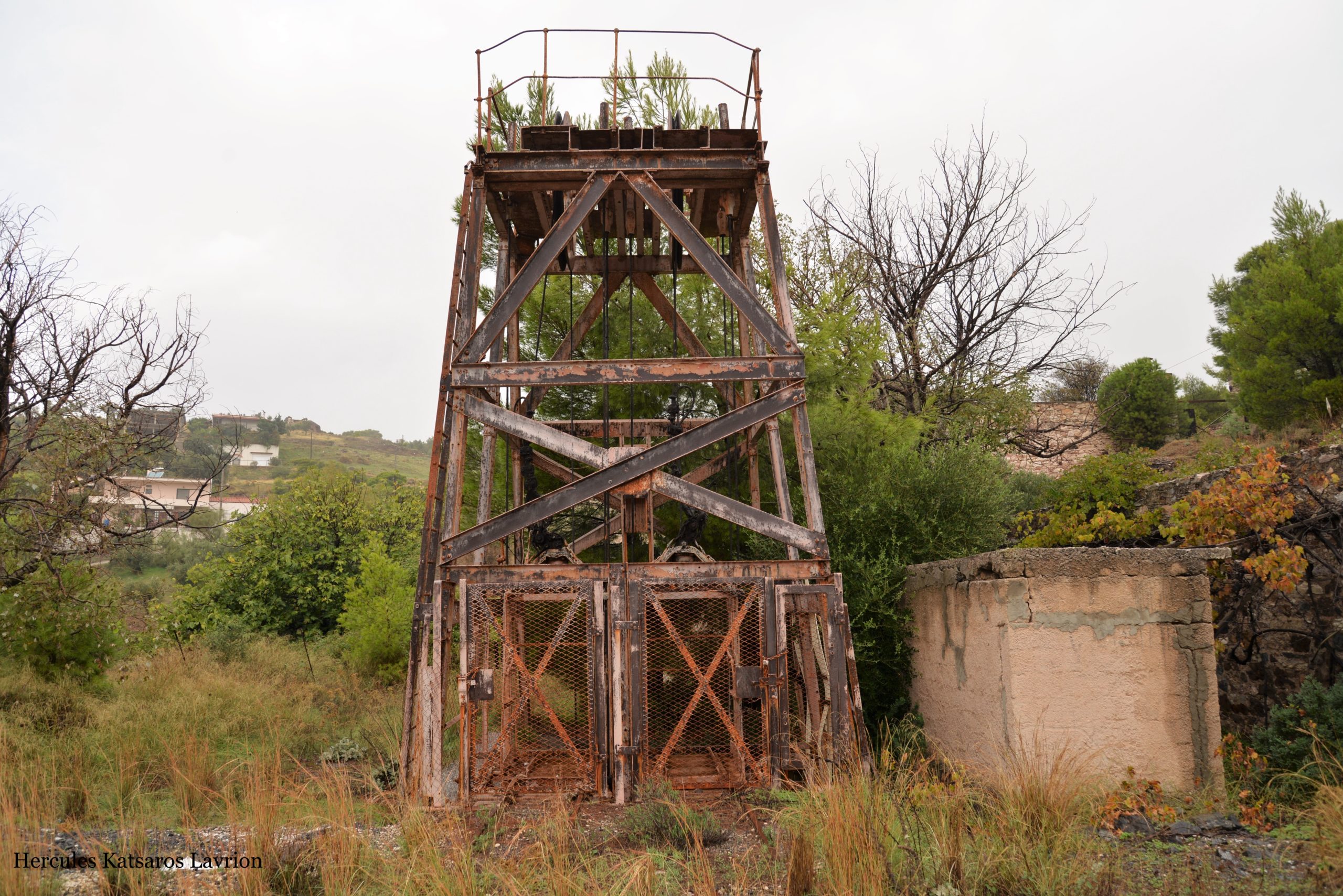
In the photos above the Well as it is today.
Photographs provided by Hercules Katsaros from his archive.
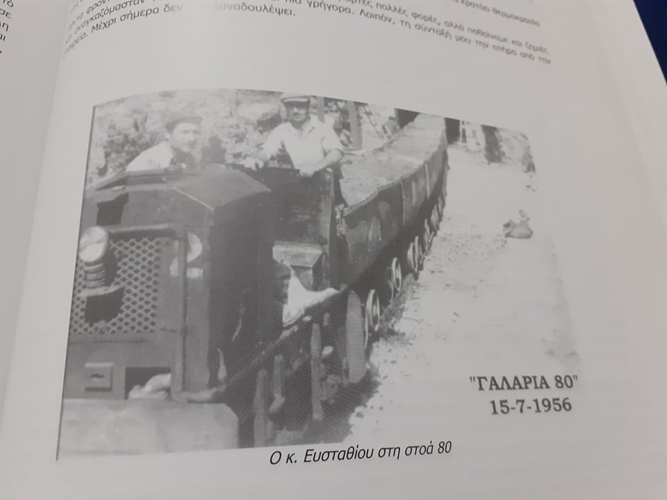
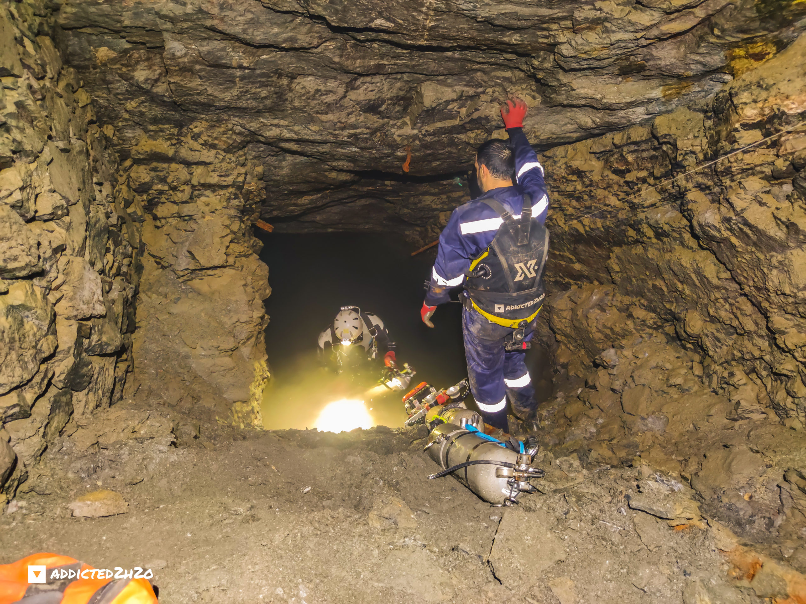
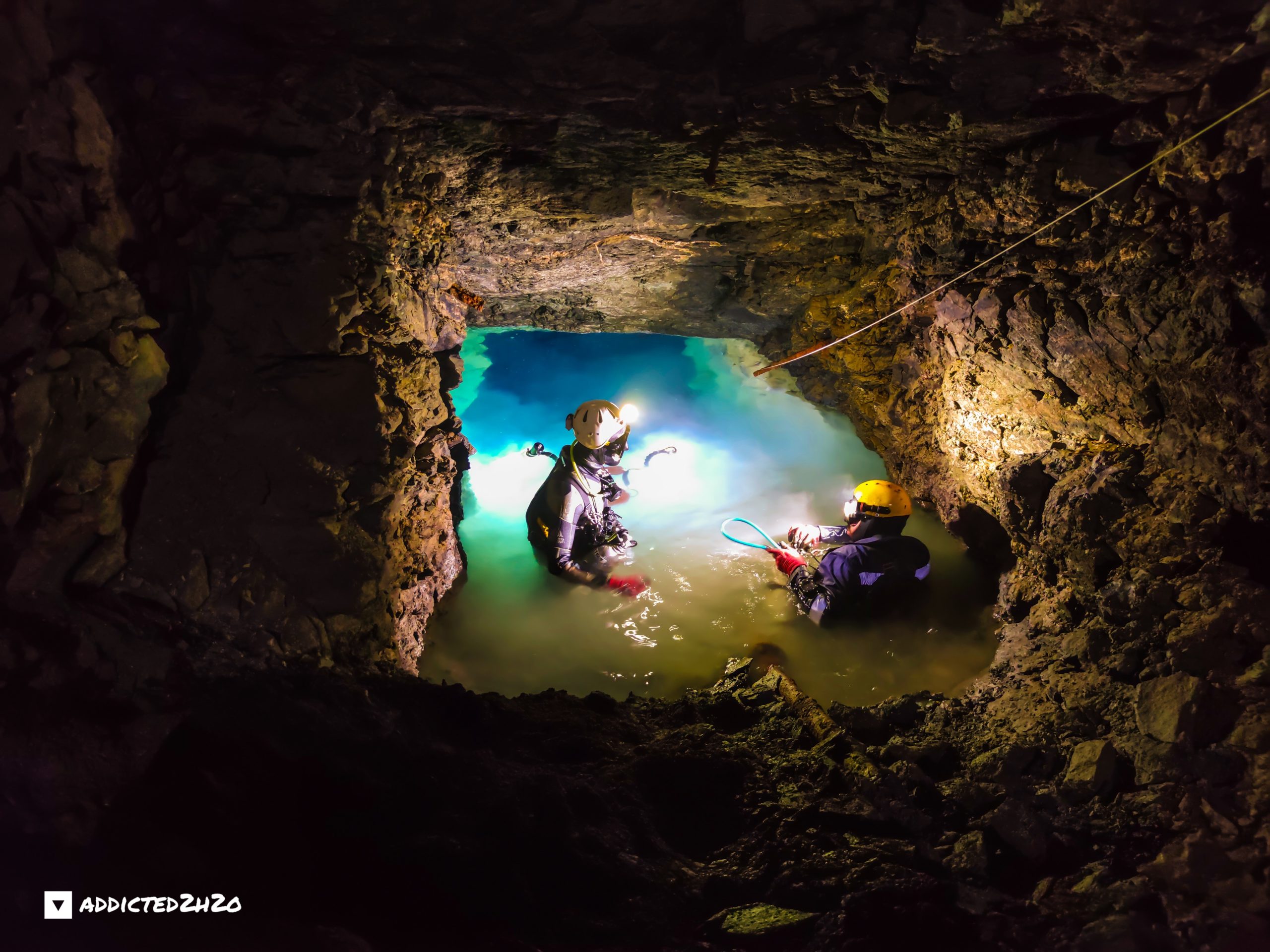
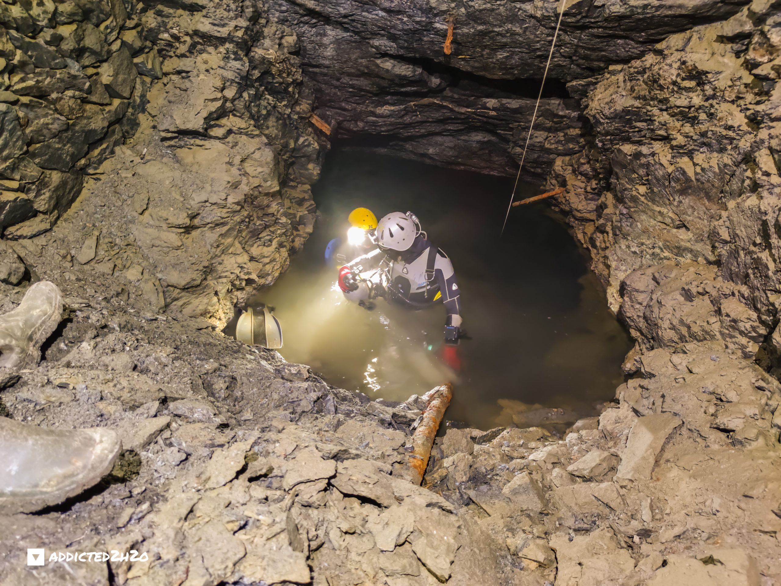
Divers Erikos Kranidiotis and Stelios Stamatakis prepare to dive on the 7th of September 2020. Photograph by Hercules Katsaros.
On the 7th of September 2020 the team visited the central gallery in the area of Plaka. Under the guidance of experienced mine explorers Hercules Katsaros and Vasilis Stergiou and support from Akis Pallis and Kostas Efthimiadis the team descended deep into the mine to search for the abandoned engine believed to have been abandoned when water from the aquifer completely flooded it in the late 70’s.
Initially a diver entered the water and observed the opening from the water surface. It was immediately apparent looking through the mask from the surface the underwater passage showed to continue straight ahead. After the divers prepared their dive gear and secured a cave line, diving commenced.
The divers entered and swam straight ahead for several meters before reaching a small ladder with 6 to 7 steps. At this point the tunnel followed a downward direction and compared to other mine dives the depth started to progressively increase. After 10 meters into the dive the divers were already at 8 meters depth. The divers noticed a lot of debris on the floor, such as old pipes, tools and timber. Further progression through a narrow opening at approximately 12 meters depth and the team entered another sloped passage until they came across a second ladder which was much bigger than the first one. This one had 15 to 20 steps and descended vertically into a very large gallery.
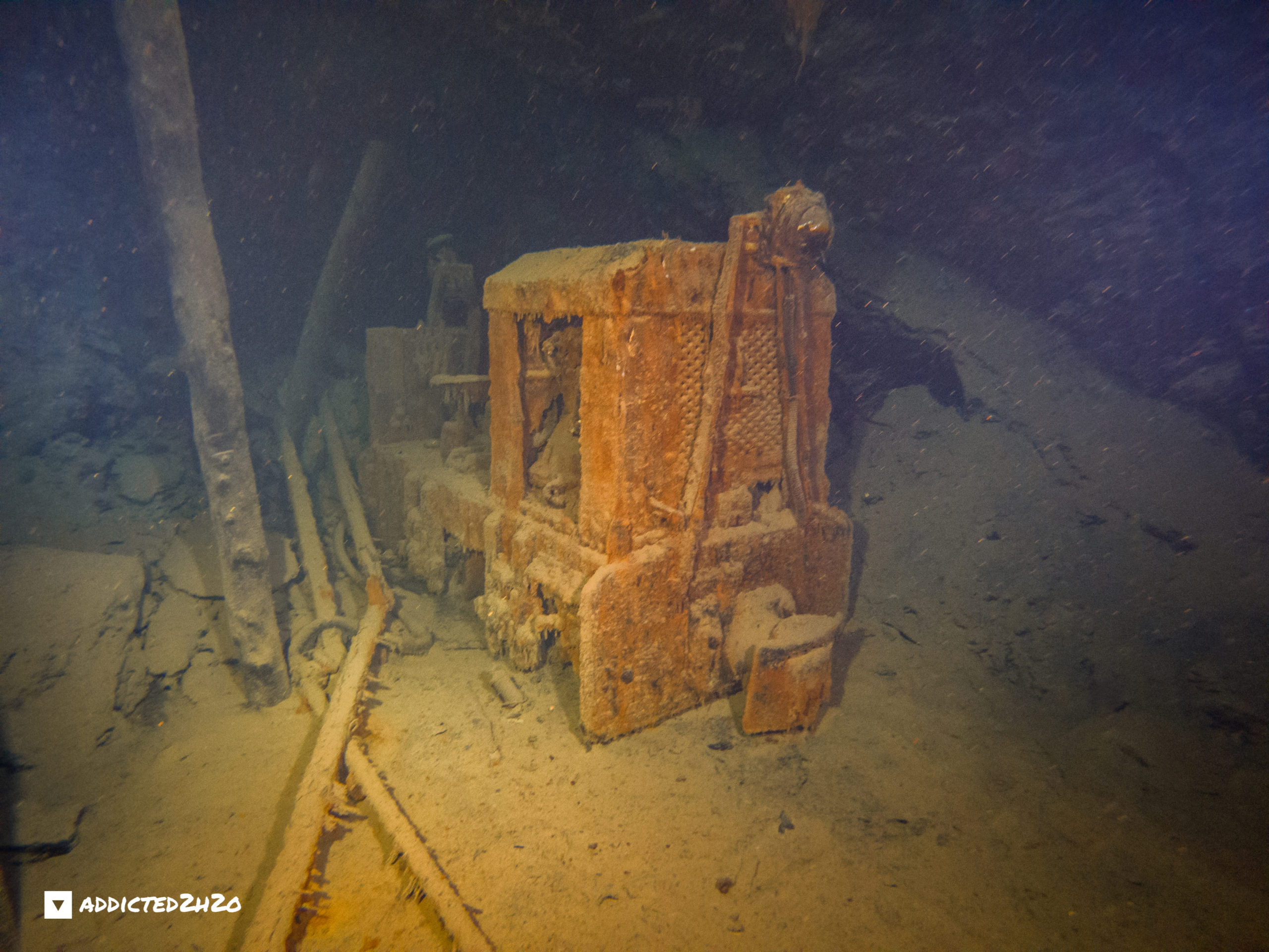
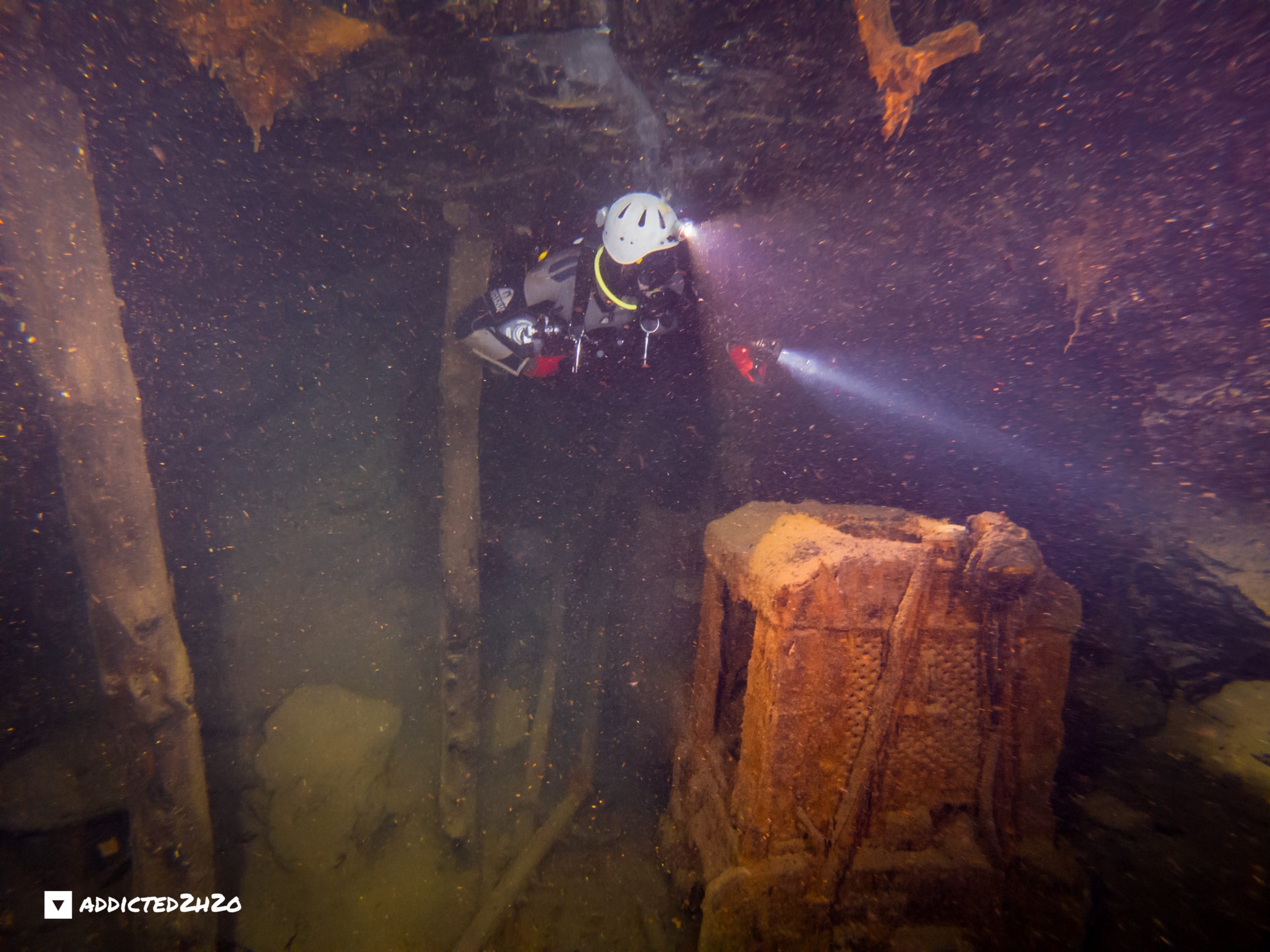
At this point the divers deliberated shortly on which direction they should follow. The depth at this part of the mine was 20meters. They followed the route which showed to have the most debris on the floor to see what they would find. Approximately after 20 meters they came across a mine wagon. It was the first time since the team started to explore the mines at Lavio, over a year now, the team finally managed to locate and film a wagon underwater. As one of the divers was securing the line, he frantically signaled to the other diver. The engine had been found!
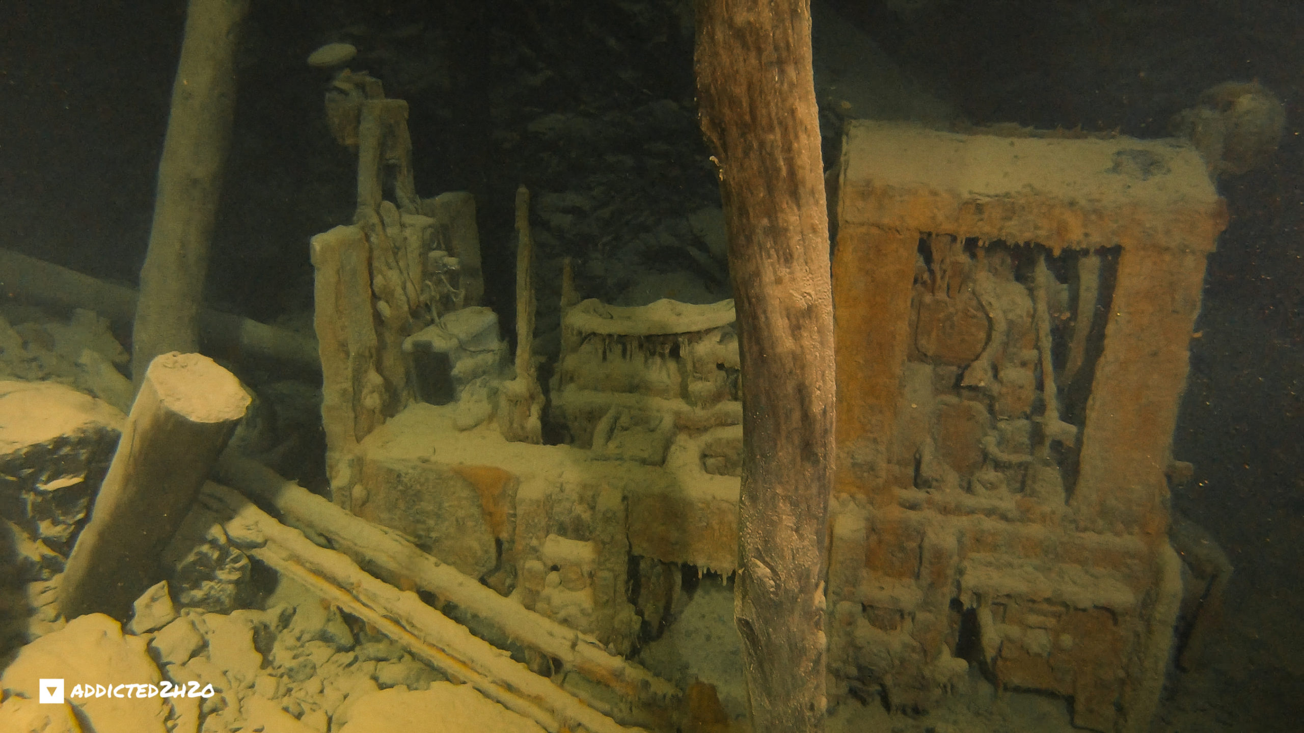
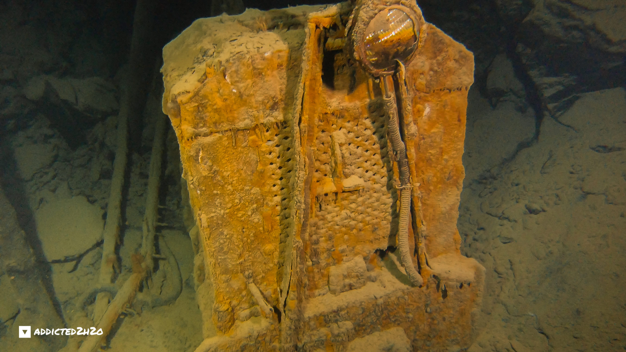
The engine discovered underwater on the 7th of September 2020. Photographed by Erikos Kranidiotis.
After filming the engine the divers continued the route revealing rail tracks through a huge gallery. The divers conscious of their air supply and having achieved the primary objective which was to locate the engine, secured the line and returned towards the exit (ladder). Here the divers shortly followed the opposite direction exploring shortly one of the two other tunnels discovered in this area until they had laid all the line. In total the line placed in this dive was 130 meters and the maximum depth reached during the dive was 20 meters. The main gallery and several tunnels which branch out are all situated at this depth. Exiting the last narrow section is done in zero visibility and the divers reach their way out, eager to share the great news to their fellow team members. The following video documents the teams efforts.
VIDEO
On the 30th of October 2020 the team visited the mine with Landmark Loutridis company to conduct a 3D mapping of the dry section. The entire route was mapped from the entrance of the mine to the entrance of the water leading to the flooded sections of the mine.
VIDEO
3D Maps
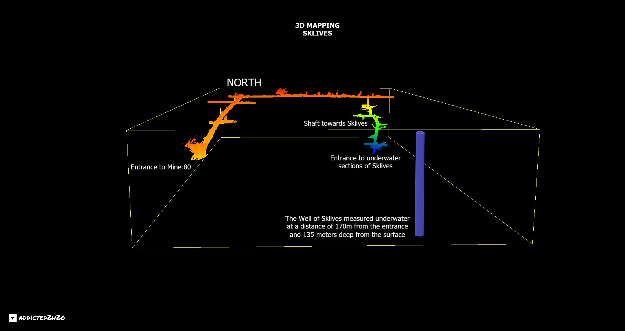
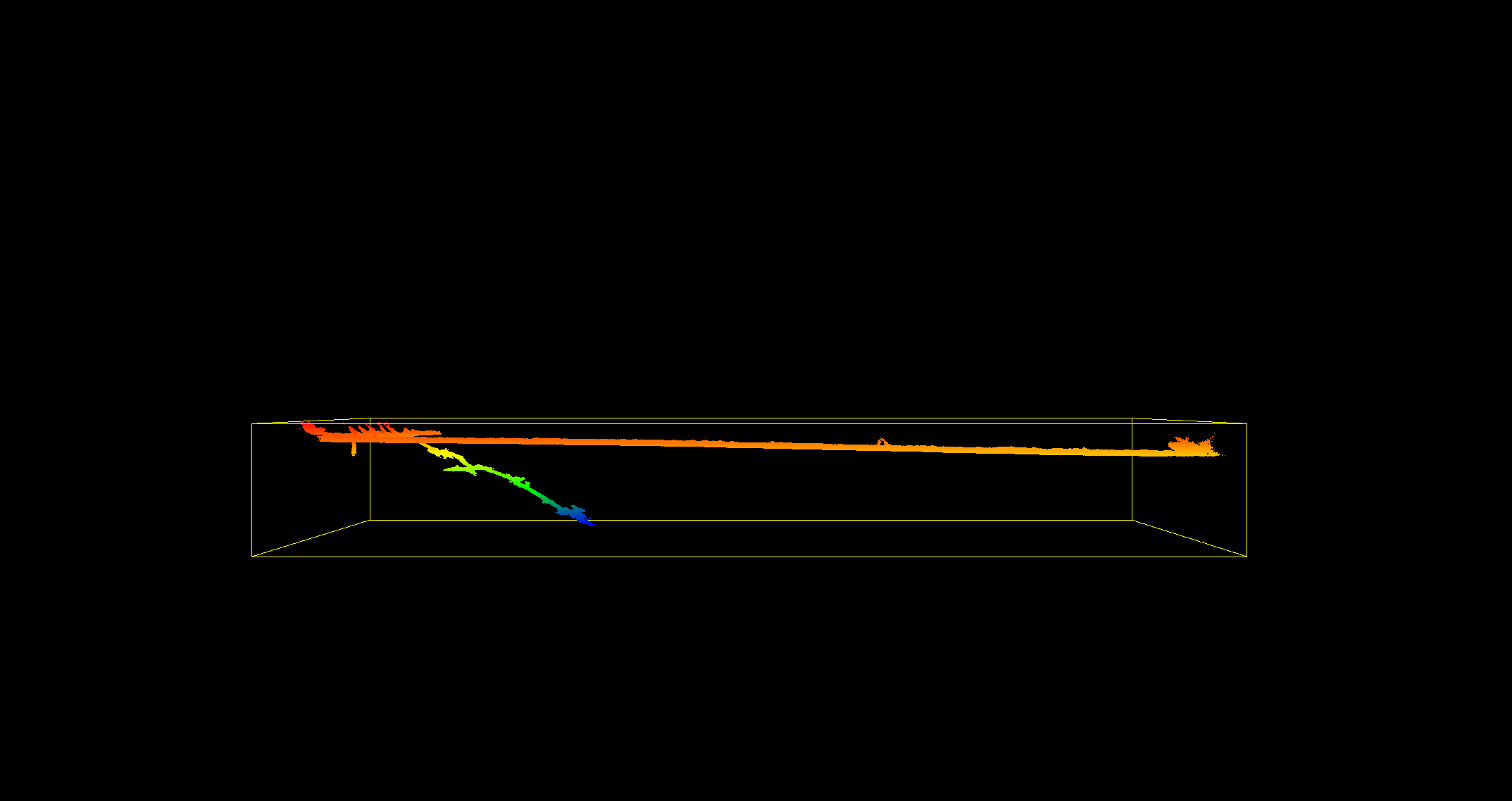
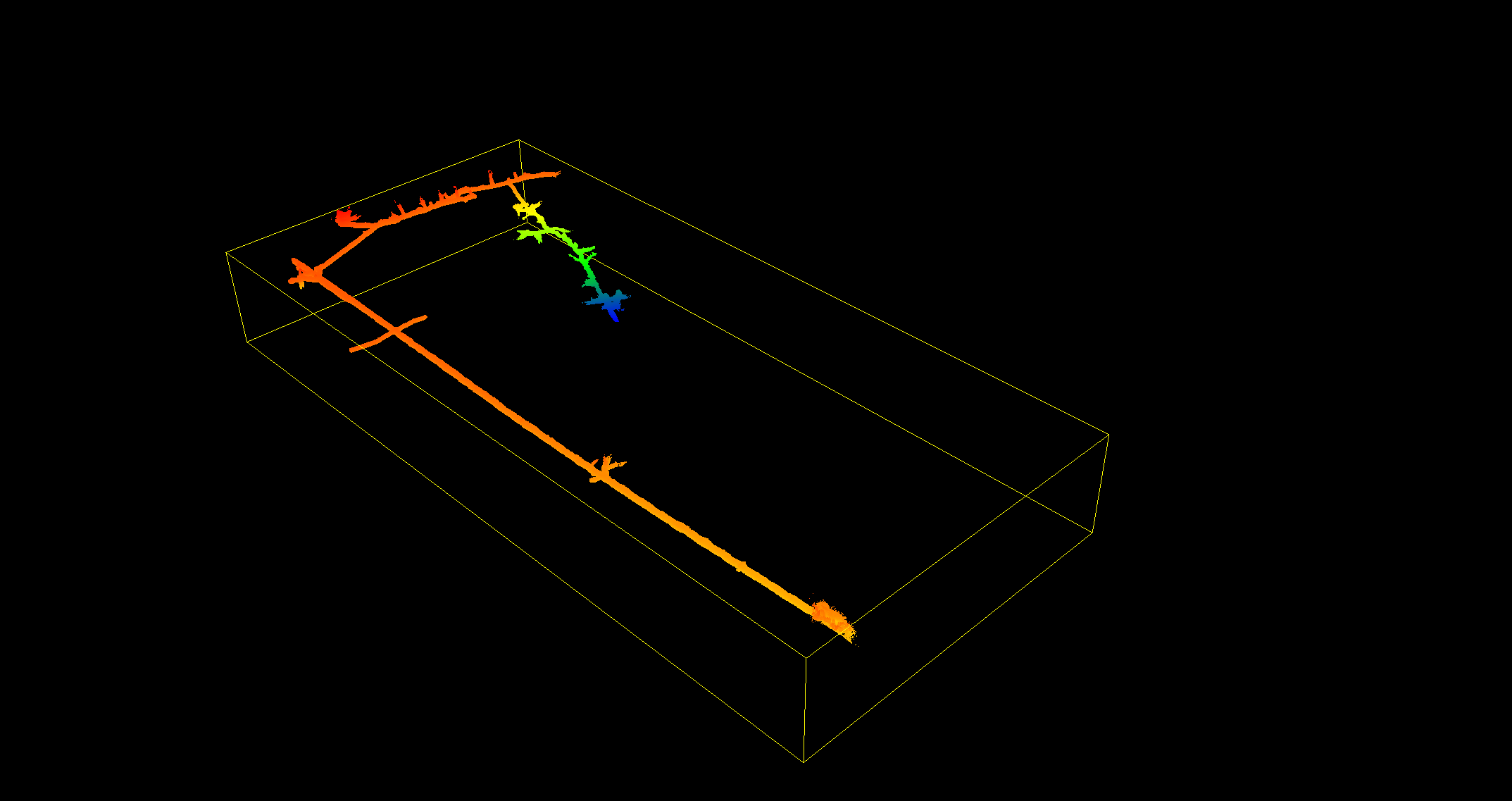
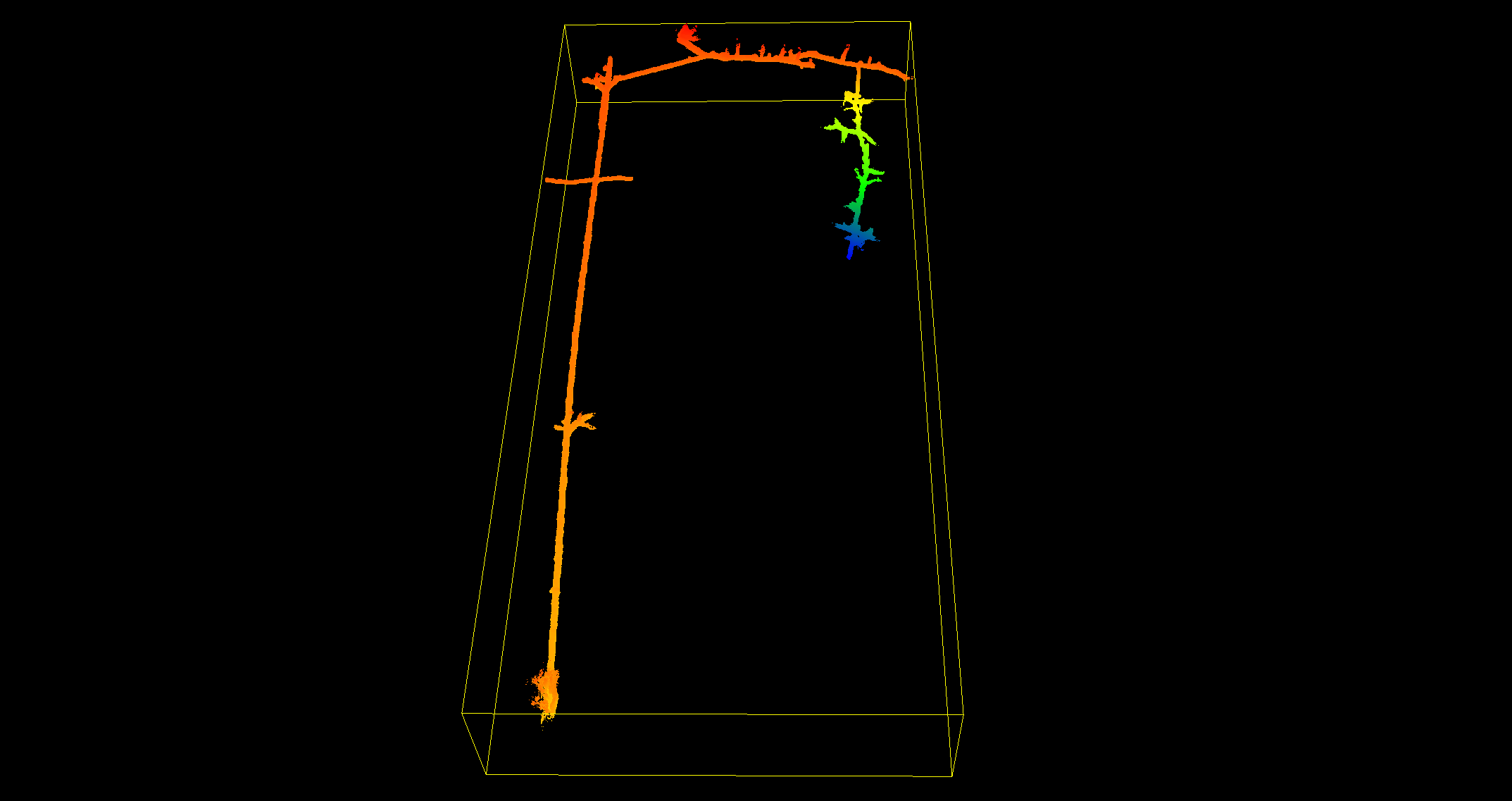
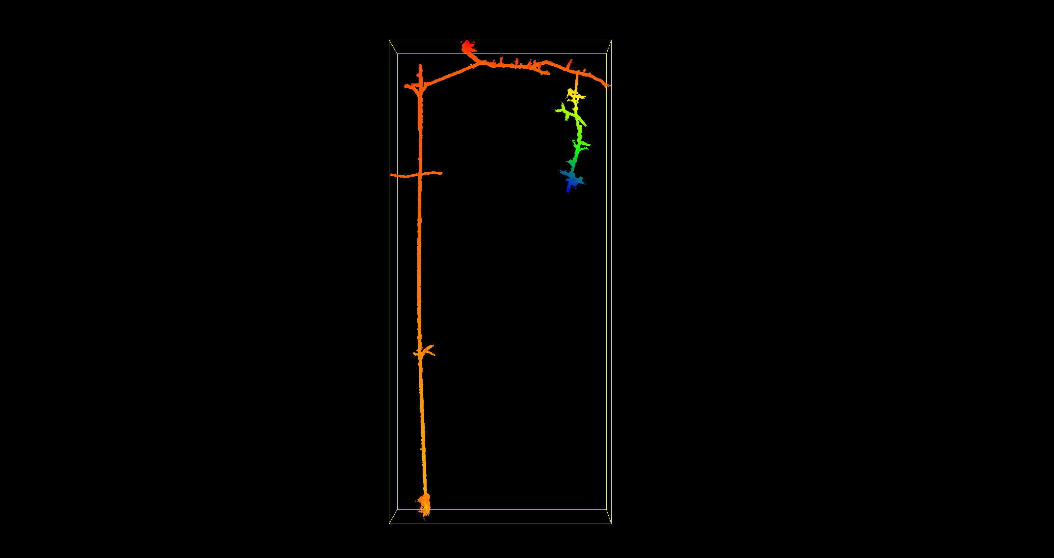
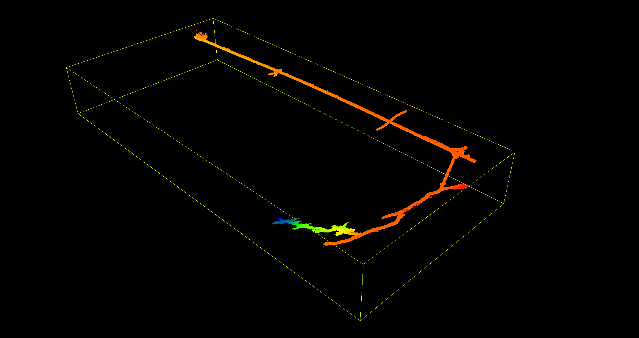
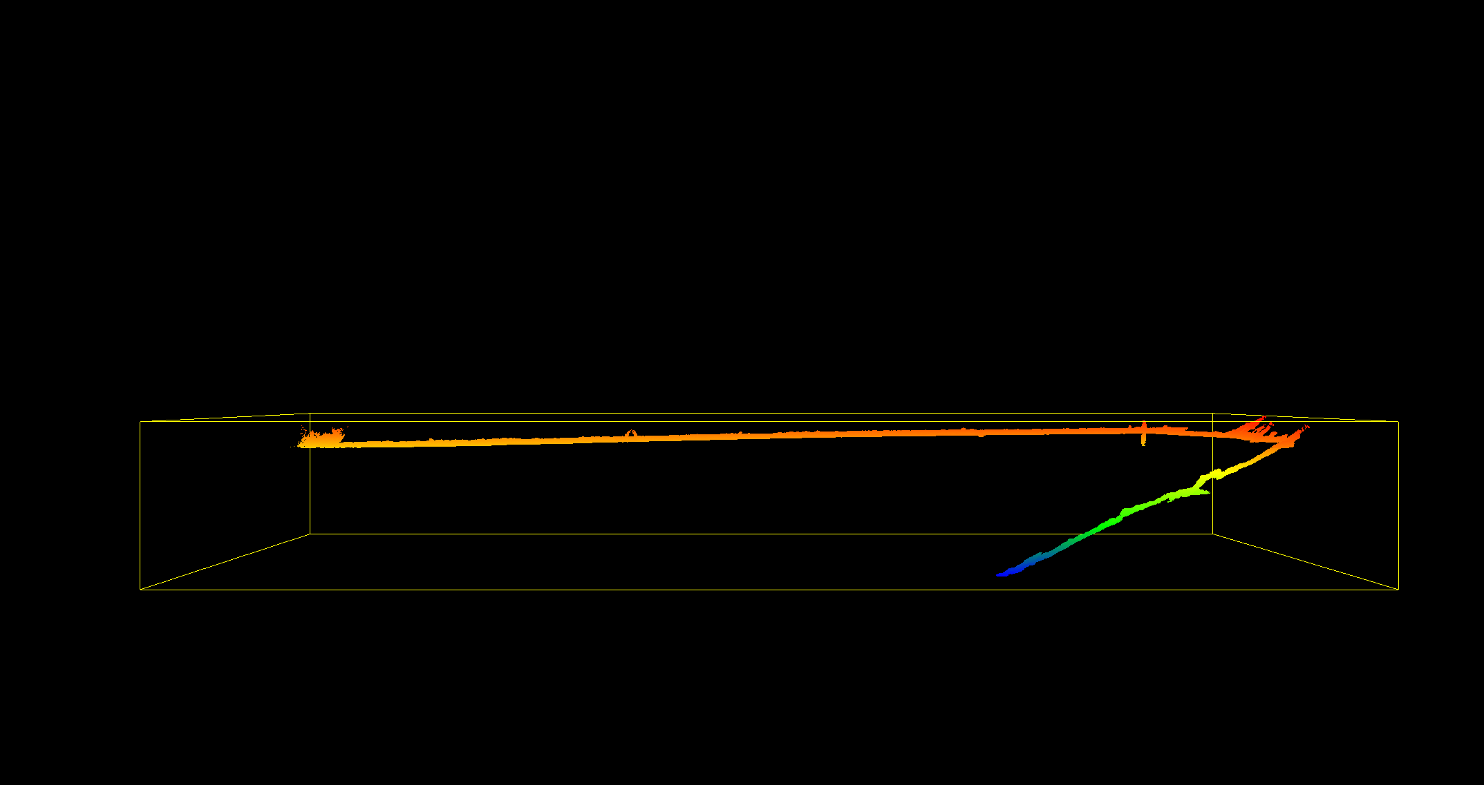
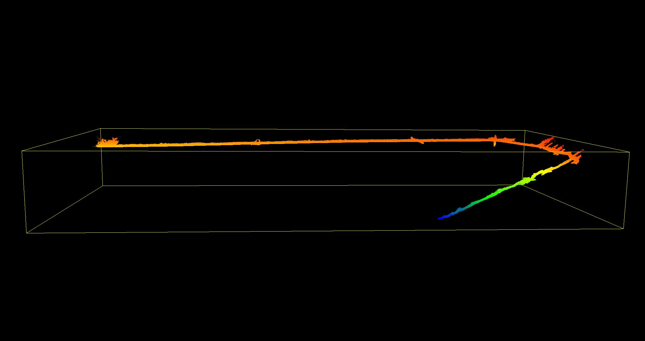
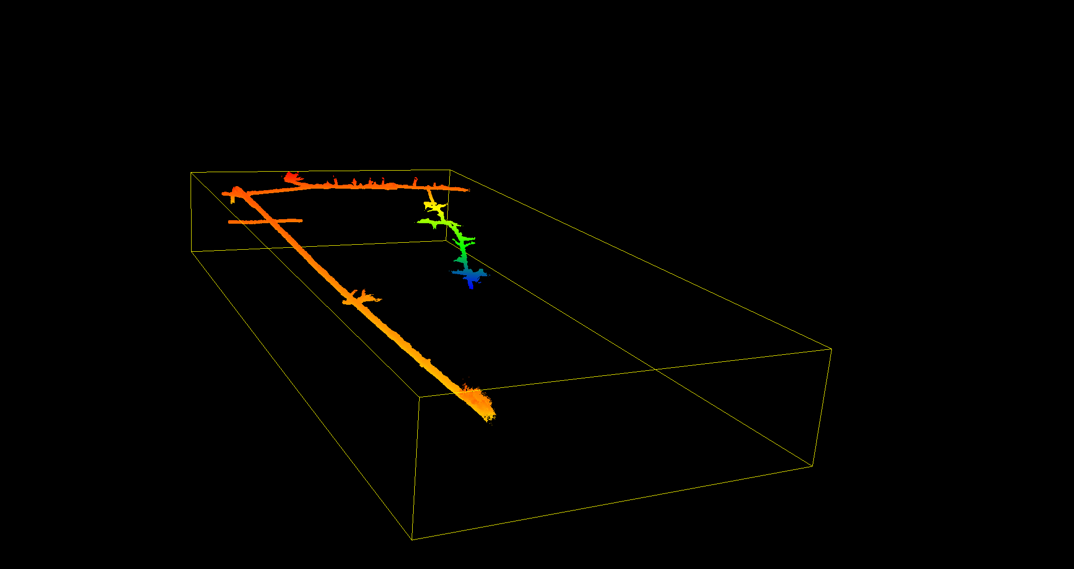
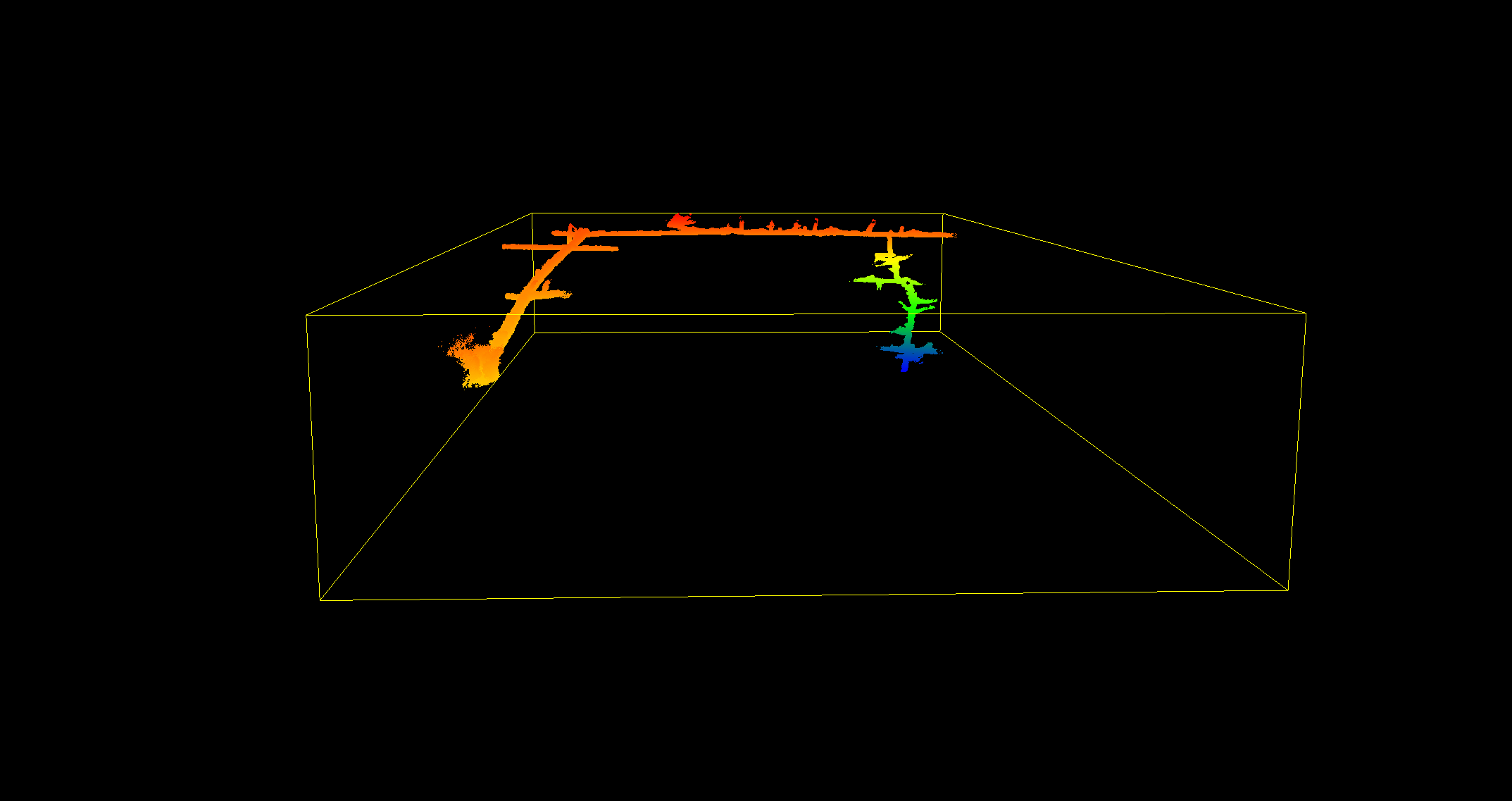
The 3D mapping in the field was carried out by Yiannis Psaltakis, Surveyor Engineer and the company Landmark Loutridis.
The above illustrations were created with the Cloud Compare software by Erikos Kranidiotis.
During the first visit the divers located the engine left by the workers when the mine was abandoned and eventually it flooded. On the 27th of December 2020 the team decided to follow the route to the North which had been partially explored towards the end of the first dive in September of 2020. Underwater it appears this mine is a very large complex of multi level galleries extending to many meters in length. It is interesting to note the water levels had receded by approximately 6 to 7 meters, thus making most of the dive much shallower. According to the mine guides the water levels change during the season. Higher levels are noticed during the Summer whilst lower levels in the Winter.
On the 17th of January 2021 the divers continued the underwater exploration South from the sump in their efforts to locate and connect with the well underwater. Additionally to further explore and map this large complex of underwater galleries. Underwater the tunnels in this direction seem much larger and in better condition than the ones encountered on the route towards North in the previous dive in December. More cave line was added to this section extending the distance which had been mapped underwater since September 2020. The divers believe they are very close to locating and reaching the well underwater, something they will accomplish in their next dive.
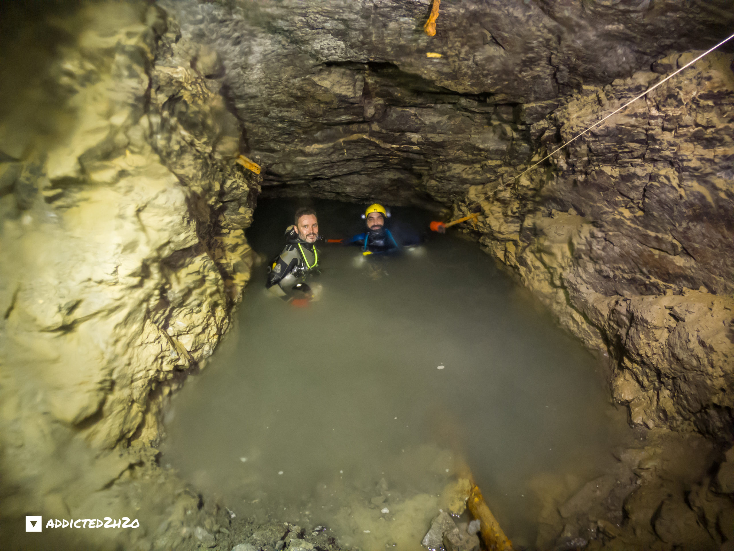
On the 27th of February 2021 the divers managed to locate and connect with the well of Sklives underwater. This was the teams fifth visit to the dive site which is situated approximately one and a half kilometers from the entrance of the mine on the surface, resulting in the team having to navigate through extremely difficult terrain. Transporting the stage tanks and dive equipment is an arduous task whilst gear configuration and dive preparation once the team arrive, is a challenge to say the least. The underwater route has been fully mapped using the Vplotter Tool and is a total distance of 170 meters from the water entrance. This tool was developed by team member Stelios Stamatakis during the covid pandemic crisis and the subsequent quaranteen periods which followed. To assist the team to locate the well underwater, a red light wrapped in plastic was thrown from the top of the well before the dive, which the divers were able to successfully retrieve underwater. The significance of mapping the arcades and mining works underwater give a new dimension to the way researchers view the Lavrio Mines, adding missing information and images to these important historical sites. In total over 400 meters have been explored underwater at this mine.
VIDEO
Sources:
-Lavrio Historical-Technological Cultural Park (www.Itp.ntua.gr/home_en)
-The Archaeological Guide of Thorikos (Ministry of Culture)
-https://el.wikipedia.org
-Kostas Papathanasiou engineer at the French Mining Company of Lavrion
Historical Research:
Vasilis Stergiou
Hercules Katsaros
Maria Fotiadi
Michalis Fitros
Nikos Leloudas
Kostas Papathanasiou
Support & Logistics:
Hercules Katsaros
Kostas Efthimiadis
Akis Pallis
3D Mapping
Yiannis Psaltakis
Mine Divers:
Erikos Kranidiotis
Stelios Stamatakis
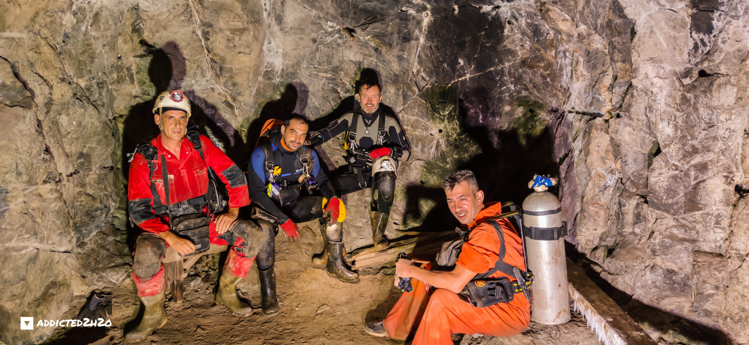
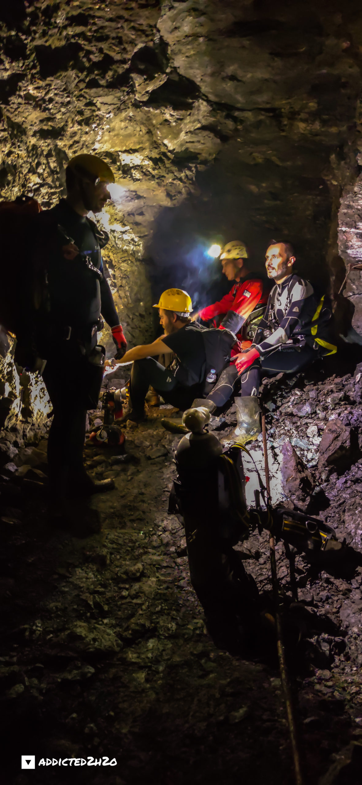
From left: Hercules Katsaros, Stelios Stamatakis, Erikos Kranidiotis, and Kostas Efthimiadis. Photo: Akis Pallis.
Do what you can’t