CAVE SURVEY TOOL
VPLOTTER
This piece of equipment was fully engineered and programmed at home to be used in our recent efforts with the Mine exploration. It is a first effort for accurate mapping and imaging of a dive route in 3d, in an aquatic environment of a mine or cave, by using the dive line as a reference. The idea for this project came about from the Mine Diving over the past year in the Lavrio area and subsequently our need to map the underwater routes.
HOW IT WORKS:
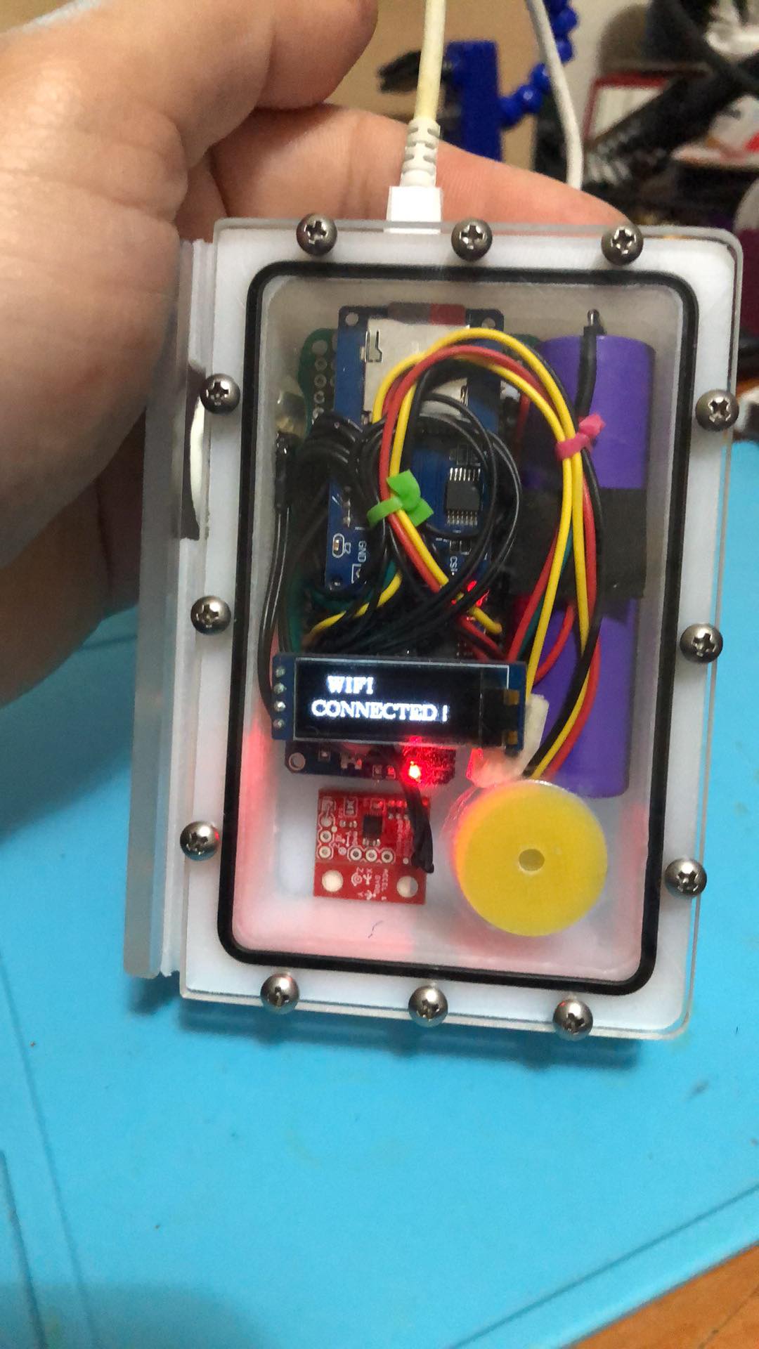
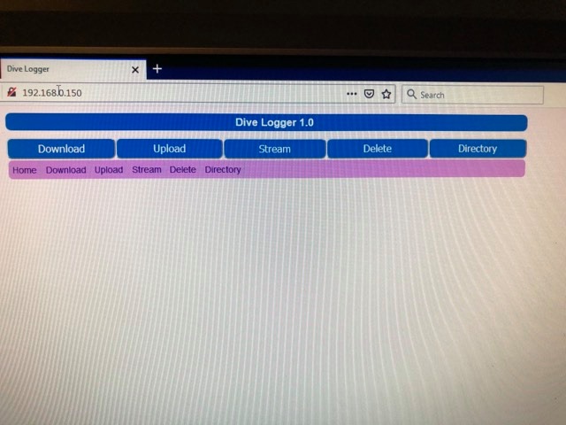
The instrument has two primary modes, one for diving-mapping and a second an ftp WiFi server in order to extract the data file with measurements from the flash card. Upon booting up, the code performs a check to see if the home WiFi ESSID is available. If it exists (therefore in the house) it then enters the second mode and starts transferring the file with the data and informs the user on the onscreen LCD display. Subsequently the user can then download, store, and delete the measurement file via a web browser very easily with 2 clicks.
When it does not find the appropriate WiFi to connect to, it will initialize and automatic calibrate all the measurement modules and in any case that some module fails it informs you on the onscreen LCD display and stops there.
Upon successful completion of initialization above, it is then ready for diving. During the dive by following the cave line, it turns the rotary encoder and at the same time informs the diver the meters traveled on the LCD display.
At the same time taking measurements of distance per (0.8m-1m), capturing and recording the temperature, compass direction/orientation, and depth in real time. It corresponds this data to an excel which is the measurement file. The divers at the end of the dive have a 3d display of the actual course in relation to the time and route they followed.
It is worth mentioning the compass is a quaternion, meaning it can take correct measurements regardless of the inclination of the instrument when holding it in the hand. The data captured during the dive can then be processed and displayed by a variety of math and display related programs, some widely available, such as Matlab. Additional configurations will be made to the program in the future, using the same hardware and a 9dof (9 Degrees of Freedom) module to capture the data without the use of the cave line. For this reason further upgrades will be made in due course.
Materials used:
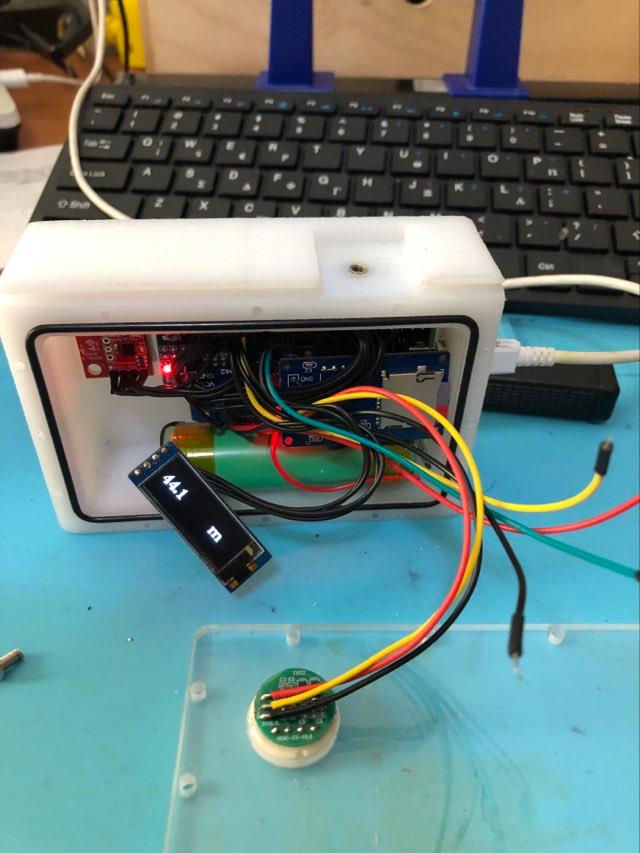
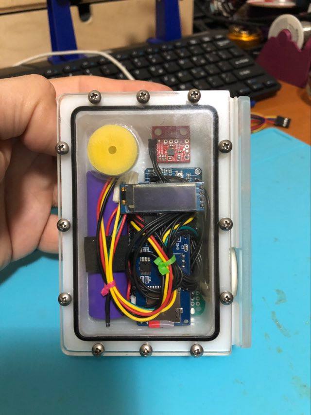
1)Analog Pressure Sensor with 0.1Bar sensitivity or i2c Pressure sensor with High Resolution(expansion port).
2) i2c Lcd Monitor.
3) Hall sensor-rotary encoder.
4)Real Time Clock.
5)SD Card module.
6)ESP32 with Bluetooth and WiFi Capabilities.
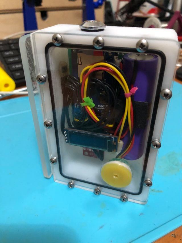
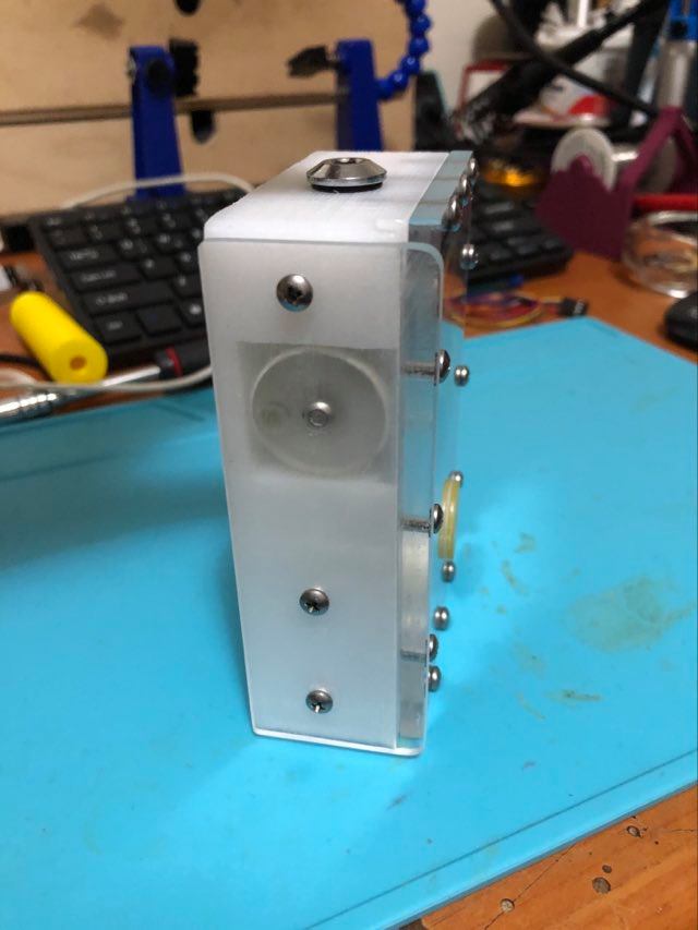
7)High Quality German Plexi Glass.
8)Lithium Battery 18650.
9)Very Small Neodumuim Magnets for encoder.
10)Derlin for plastic case.
11) 9dof Imu i2c compass (9 Degrees of Freedom).
12) 1 regulator port 7/16inch.
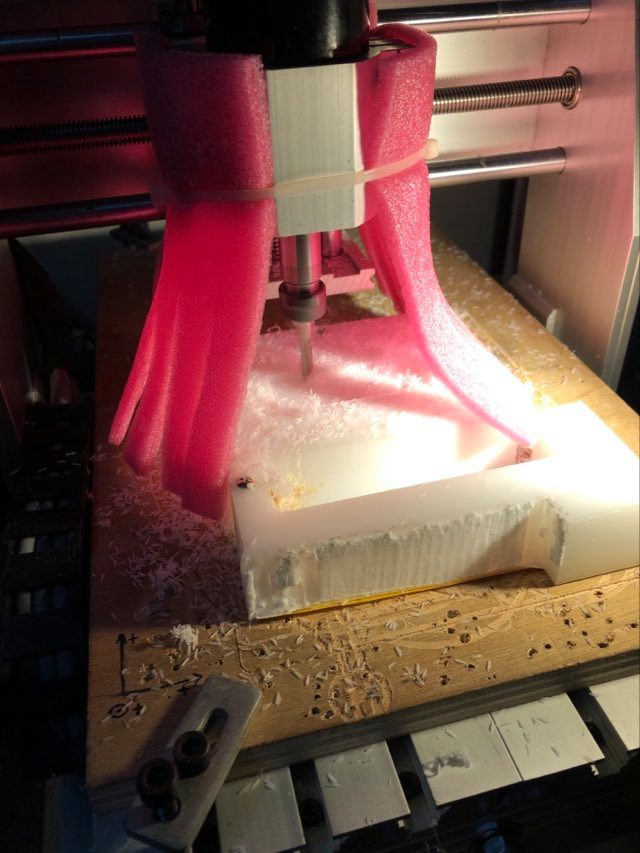
… much time spent on designing ,testing, coding, and debugging…
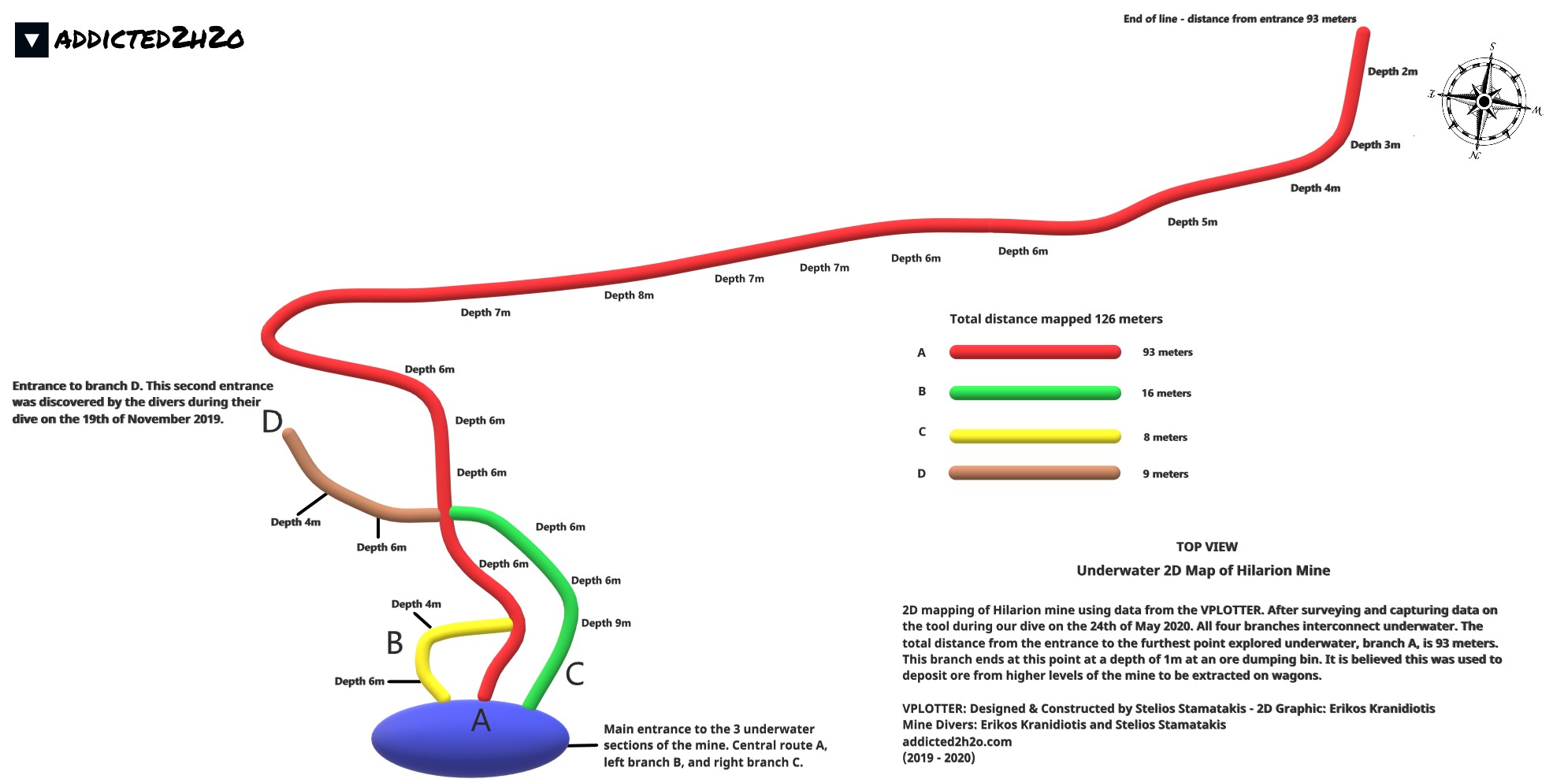
A 2D map of Hilarion Mine using data from the VPLOTTER.
ADDICTED2H2O
Do what you can’t